
NEW ORLEANS —
New Orleans Latest Weather Forecast
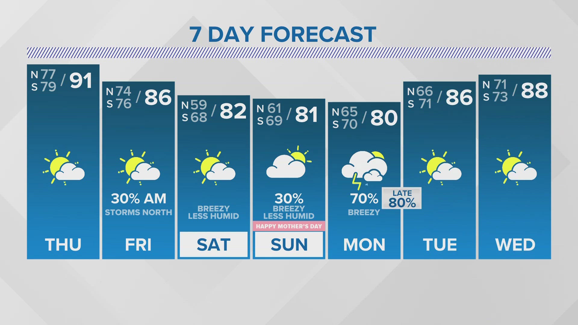
Thursday is shaping up to feel more like a July day rather than May. Temperatures will soar into the low 90s this afternoon with feel like temperatures as high as 104 degrees. The record high of 91 degrees set in 1986 could fall today.
Tonight a complex of strong storms will dive out of Texas and race across Mississippi. It looks like most of the storms will stay to our north impacting areas like Jackson, McComb and Hattiesburg. These storms could produce intense winds and quick spin up tornadoes. It still looks most of the storms will miss South Louisiana.
The cool front will move through early Friday, but milder temps and lower humidity may still be lagging behind until later in the evening. Saturday looks great with highs in the low 80s and less humid air!
Mother's Day is trending drier with only a 20-30% chance for a shower. An upper disturbance will hold off the rain until Monday and into Tuesday. 1-3" of rain possible with a few locally heavier amounts. Low confidence on a severe threat.
Detailed Forecast:
THURSDAY:
Partly sunny. Hot and humid. Near record heat. High: 92. Winds: S 6-12.
FRIDAY:
Mostly cloudy. 20% early AM storms, mainly Northshore, MS. Then becoming sunny. Milder, less humid by the evening. Low: S 76, N 74. High: 89.
SATURDAY:
Mostly sunny to partly cloudy. Milder, low humidity. Breezy. Low: S 68, N 59. High: 83.
MOTHER'S DAY:
Partly to mostly cloudy. 20-30% few showers. Mild, low humidity. Breezy. Low: S 69, N 61. High: 82.
MONDAY:
Mostly cloudy. 60% showers and storms. Mild, more humid. Low: S 70, N 65. High: 80.
TUESDAY:
40% early AM rain, then some clearing. Warmer, more humid. Low: S 71, N 66. High: 86.
WEDNESDAY:
Sun to partly cloudy. Very warm and humid. Low: S 73, N 71. High: 88.